 Sri Lanka recently joined the ‘Space Club’ of nations which have either sent people or satellites to space with the launch of its first-ever locally designed Sri Lankan nano satellite, RAAVANA-1. Now in orbit 400 km away from Earth it has sent the first picture of Earth (with a special focus on Sri Lanka, naturally) taken by its on-board high-resolution cameras.
Raavana-1, named after the legendary warrior, is a research satellite built by two Sri Lankan engineers, Tharindu Dayaratne and Dulani Chamika, from the University of Peradeniya and the Arthur C. Clarke Institute for Modern Technologies. Theirs is a singular achievement that deserves more recognition and plaudits.
The satellite was designed and built at the Kyushu Institute of Technology in Japan and is 1,000 cubic cm in size and weighs 1.1 kg. It was officially handed over to the Japan Aerospace Exploration Agency on February 18. It was successfully launched into space at NASA’s Wallops Flight Facility on Wallops Island, Virginia on April 18. The satellite was boarded to the Antares rocket carrying Cygnus cargo spacecraft to the International Space Station, from where it was launched along with two other such nano or cube satellites from Japan and Nepal.
We hope this is only the first in a series of such satellites to be built according to local inputs and designs that would address our needs and concerns. The Raavana-1 satellite is expected to fulfil five missions including the capturing of pictures of Sri Lanka and its surrounding regions during its lifespan of up to five years. A team of scientists must be deployed to analyze this data in the coming years.
This is indeed a noteworthy achievement that shows the innovative streak of Sri Lankan engineering students. The two students, who are currently studying overseas (Japan) have shown that they have the interest of Sri Lanka at heart. Brain drain usually occurs when students decide to stay back in their host countries and get permanent residency. This is a huge loss to the country which has funded their education. However, the two students have set an example to others by their act.
It is vital to have our own geosensing and weather satellites because we cannot always rely on the satellites that essentially belong to or are controlled by, other countries. Sometimes we have to pay enormous sums to obtain such satellite data and it may make sense to have our own nano satellites, if not big satellites, in the long run.
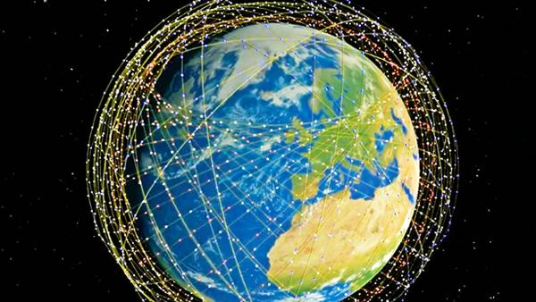
It would not be incorrect to say that satellites keep our world going. Thanks to a network geosynchronous communications satellites placed 35,786 Km above the Earth, we can instantly watch and listen to sports and news events happening on the other side of the world. Incidentally, this idea was first mooted by Sir Arthur C Clarke, the visionary and futurist who called Sri Lanka his home.
Fifty years ago, only 630 million people watched the live broadcast of the moon landing. Today, the soccer world cup final attracts more than two billion people to their TV sets. These satellites also help route International Direct Dialling (IDD) telephone calls and Internet services. Very soon, satellites will be used to deliver super fast and affordable Internet services at speeds that can rival the latest 5G networks in terms of speed. For example, Amazon’s Project Kuiper aims to launch a network of 3,236 small satellites to create an interconnected network that beams high-speed internet to anywhere on Earth. OneWeb, an internet satellite company backed by the likes of SoftBank, also has plans to launch about 650 satellites into orbit over the next two years to power the Internet.
There is also a separate network of satellites known as Iridium which facilitate handheld satellite telephony. Millions of motorists would be lost in strange cities and countries without the Global Positioning System (GPS) satellites now in orbit around the Earth. This system now provides guidance for aircraft as well. From archaeology to analyzing forest cover and crop cover to tracking ocean currents, satellites provide us with a wealth of information every second of the day on a 24/7 basis.
Mankind is so advanced now, we even have satellites orbiting several other planets in the Solar System. Indeed, we know more about the dried up oceans of the Red Planet Mars thanks to these robotic probes than the Earth’s own vast oceans. Moreover, the days when only Governments used to be involved in the satellite business are long gone now. Now there are companies like Elon Musk’s SpaceX which can blast satellites off into space for a modest (by space standards) fee. Even the least developed countries would soon be able to launch their own satellites at this pace.
But there is another solution that does at least some of the tasks performed by satellites at a far lesser cost – drones. They now cost a fraction of what they used to cost, with a bigger range and better battery endurance. Governments used military-grade advanced drones for everything from surveillance to crop assessment, not to mention their somewhat controversial use in conflict as carriers of weapons. Indeed, researchers in Sri Lanka must be encouraged to develop drone applications that break new ground – perhaps literally.
But autonomous drones that can be purchased off the shelf by individuals like you and I are getting there in terms of performance and power. Just like satellites they can be used for land use surveys and high-resolution photography, but drones are even more versatile than satellites in terms of what they can possibly do. Amazon is already experimenting with drones that can deliver small parcels and some countries have trialled the delivery of life-saving medicines to remote communities which cannot be reached even by helicopter. They have turned out to be life-saver in times of natural disasters by locating survivors quickly. And just like satellites, they can be programmed to work in unison.
An example for the latter comes from Norway. So far, flying robots have enabled farmers to live stream crop growth, patrol for pathogens and boost farm efficiency. The next step is to recruit squadrons of them that can co-operate and carry out their tasks without the need for a human pilot. Scientists from the Norwegian Defence Research Establishment (FFI) and the US’s Rajant Corporation are working on simultaneously flying about 20 drones that can work in co-ordination with little human supervision. A simple command is all that is needed for the robots to self-organise and communicate in a decentralised way.
There are fears that both drones and satellites can be used by non-state actors to cause harm. In fact, a drone was used in the assassination attempt on a world leader sometime back.
There must be safeguards and guidelines for the operation of satellites and drones by non-state parties to ensure that these emerging technologies are used only for good deeds.