Imagine you are driving to a destination that you are not totally familiar with. In the past, you had to stop at many points along the way and ask for directions from residents and passersby. But not anymore. You simply log onto Google Maps on your phone or the in-built navigation system in your car and voila, you get voice guidance right to your destination or address. All the hard work is done by the network Global Positioning System (GPS) satellites that track your vehicle.
Without really thinking snout it, I have already outlined two things that shape our lives today – satellites and smartphones. GPS used to be an expensive military technology but now it is accessible to everyone. In fact, satellites help us in so many ways from weather forecasting to global news coverage. And almost everyone has a smartphone 24/7. The convergence of these two technological marvels has transformed our lives drastically.
Inexpensive
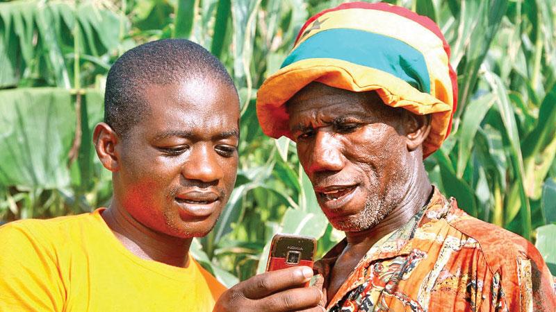
Fortunately, these trends are no longer confined to the rich. Smartphones are already inexpensive and are commonplace even in rural areas. There are positive developments in the smartphone field that can help rural communities. This week, I found a particularly good example from Kenya that Sri Lanka too can adopt. This is especially timely in the context of the “Sena” caterpillar crisis that has engulfed many agricultural areas.
Kenyan scientists and telecom companies have developed a smartphone app called Plant Village — just point your phone at a diseased plant, and artificial intelligence will analyze the leaves and tell you exactly what is wrong with the plant so that you can seek a solution. And it is gaining new capabilities thanks to satellites. Using free satellite data from the UN, Plant Village can monitor biomass on a plot of land, giving small-scale farmers an insight into how their crops are developing, according to a report in Wired magazine.
Researchers are testing the new system in western Kenya, handing out phones to ‘lead’ farmers, who then enlighten their neighbours. Crop data is updated every 10 days, so the farmers can track growth over the course of a whole growing season.
This kind of technology was available only to mega agricultural companies, once, and was unobtainable for small-scale farmers. With this new service from Plant Village, all it takes is one smartphone per community, for farmers to receive essential data.
“If it’s not going well, then you have to do something very different from what you’ve done before, either plant a different crop or start irrigating,” says Penn State biologist David Hughes, who developed Plant Village. Interestingly, the satellite data also reaches back several years, so you can see how well their plants are performing over a period of several years.
And call it jealousy or envy, you can compare your plot to your neighbour’s and see whether you are performing better or worse than him. All other things being equal, if his crop is doing well and yours is not, you can look for answers right away with the help of Agri officials in the area.
This is an interesting idea that our app makers and Agri scientists should explore. It should of course be offered in the vernacular languages. This is especially important in the age of Climate Change, because agriculture is the hardest hit. For generations, paddy farmers in Sri Lanka and other Asian countries have relied on a consistent rainfall pattern to sow seeds and harvest the crop. But with the onset of Climate Change, these patterns have gone out of the window to be replaced by unpredictable rain and drought patterns. But with satellite technology, farmers will be able to get a better idea of climatic and other conditions that impact on their cultivation.
With this satellite data, they can take decisions before it is too late. The satellites, which can of course see things that we cannot see, are looking at a couple of things. They use near-infrared sensors to measure land surface temperature, which helps calculate soil moisture. It can be used to see how healthy a crop is, and it can tell you what part is water and which part is bare soil. Right now, this data is not available at a particularly high resolution—pixels of a 100 metre square. That resolution will improve: new satellites are likely to sharpen the resolution to a ten metre square, giving farmers ever-better diagnostic tools.
This is also an opportunity for our app developers to shine. Along with Agri experts, they should find out the needs of the farming community vis-à-vis smartphone technology. From apps that flash the latest Agri news to apps that predict crop prices, there is a plethora of requirements that can be satisfied by such aps.
This type of new technology will also help attract more young people to agriculture. Now the sons and daughters of farmers are leaving the villages for white collar jobs in the city as they do not want to be seen in a manual job. But if an element of technology from ultra-modern tractors to smartphone apps is added to the mix, some of them might opt to remain in farming.
Drones
Drones are another alternative that can do much the same things, but the initial cost will be prohibitive to most farmers. Major agricultural companies, including some in Sri Lanka already use drones for surveillance work. However, in the near future, drones should be much more affordable with greater battery power, making them ideal for agricultural work. As economies of scale kick in for drone manufacturers, they will get much more commonplace.
It is time for Sri Lankan inventors and he scientific community to plunge into the agriculture technology field.
This field is driven by the achievement of operational efficiency and effectiveness through heavy acceptance of technology in farming practices which is projecting a rise in estimated value from USD 7.68 billion in 2018 to an estimated value of USD 19.86 billion by 2026, registering a Compound Annual Growth Rate of 12.61% in the forecast period of 2019-2026. This is indeed a huge market and we should try to take a slice out of this pie.