On the upcountry railway line, Station No 68 is Idalgashinna. This small town located between Haputale and Ohiya, in the Badulla district, is 1,615 m above sea level.
Numbering eight lucky hikers, we started our journey from Haputale to Idalgashinna (IGH) sharp at 7 a m by foot. There were no dark clouds nor any signs of rain, and it was not so cold either. On our way, passing the Tangamale sanctuary, on the left we could see the famous IGH Haputale gap. It was a breathtaking view. The mist together with the clouds passing over the mountain range created magnificent artistic designs. After a three hour trek we managed to cover 8.5 km, to reach our destination, IGH.
But sadly, not much could be seen. It was very dark. The small town of Idalgashinna, was covered by a blanket of thick mist. Though nothing was visible, we could hear the voices of children very clearly, and within seconds IGH appeared like a blurred picture.

The IGH Railway Station, stood on an elevation of 1,615m above sea level. On its left is the Government Tamil School and next to it the resident’s Housing Scheme. The Post Office was on the slope, along with two boutiques.
After a short break, around 10.15 am we continued our journey, walking about 250 metres towards Ohiya, and took a turn to our left, where the track starts to the mountain.
Idalgashinna is an impressive mountain viewed from the surrounding countryside. It is situated about 1.3 Kms from the Railway Station. The track was not difficult and ended near the huge water tank. From there onwards the path was not clear. As we passed the water tank on the left, a stone paved footpath led straight up to a patch of pine forest.
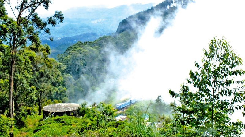
We walked through tea bushes, while the tea estate spread out onto the left of our trekking path. Taking a break, we looked back along the path that we trekked, and could see the tiny station enveloped by thick mist, while the Podi Menike train was arriving at the Station breaking through the net of mist, like a millepede (hekarella). On the roadside lay a bunch of guava, inviting us to taste them, but we reluctantly refused and continued our tour further up, the mist moving faster than our trot. At times the path was slippery due to the wet ground. On our right, was the pine forest patch.The shadow of the pine trees looked like hand paintings, through the mist. White clouds engulfed the surroundings, but the Beragala mountain top looked as though it was peeping over the clouds. As we entered the pine forest we faced difficulty in climbing. The dried pine leaves are very slippery and one should think twice before taking a step forward, as there is nothing to hold on to. We reached the final part of the steep climb, and after nearly an hour, we arrived at the summit.
The thick mist didn’t move, embracing us tightly with the cold air. The team spent more than one and a half hours enjoying the unique surrounding, the breathtaking scenery of the Samanala Wewa Reservoir, Bambarakanda waterfall, Wangedigala, Balatuduwa, Gommolliya, Beragala mountains and the border of the Horton Plains, from the mountain top.
The weather had been great lasting our whole trip, and we certainly enjoyed every minute of it.